The Link between Geodesy and Climate Change: Monitoring Sea Level Rise and Land Subsidence
We live in a world of continuous change, but not always for the better. Climate change is not a new concept for any of us, and we can feel it through various side effects. The global temperature has risen by 1 degree Celsius since the Industrial Revolution, storms are wreaking havoc in areas that were usually clear, and the times of increased drought are worse than they’ve ever been before.
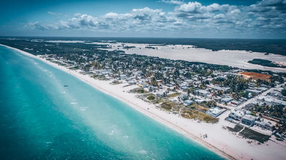
Among the worst parts of climate change is the sea level rise. Cities in the United States are nowadays spending billions of dollars to stop the effects of coastal flooding. Many cities are already sunken underneath the sea, and many others may be expected to go underwater by 2050.
How we know this is simple: we’ve seen the maps. We’ve seen how the lands changed, how there is less land now and more water. We’ve seen the continents change their shape, and drift apart as the tectonic plates started shifting. And as this happens, the climate is also taking a hit. Slowly, but surely, it’s changing.
But what exactly is geodesy, and how can it help us understand climate change? In this article, you will learn how monitoring sea level rise and land subsidence can give us a better understanding of climate change.
What Is Geodesy?
Geodesy is the science of measuring the shape, size, mass distribution, and orientation of the Earth. This collection of accurate measurements gives us a better understanding of how its shape changes with time and what we may expect from the future.
In the past, geodesy was used mostly for this: surveillance, to determine exactly what the earth’s position is. Now, there is a greater toolbox of appliances that researchers and students can use. In the past few years, geodesy went from monitoring earthquake hazards and plate motions to mapping landslides, volcanic activity, climate change, weather damage, and water resources.
Several system types are used to determine the geodetic data of the earth, including:
- GPS (Global Positioning Systems)
- GNSS (Global Navigation Satellite Systems)
- LIDAR (Light Detection and Ranging)
- InSAR (Interferometric Synthetic Aperture Radar)
- GRACE (Gravity Recovery & Climate Experiment)
- Altimetry
- Meters (tilt, borehole, creep)
For the most part, geodetic tools such as GPS were used to determine horizontal and vertical motion, as a way to potentially predict seismic and tectonic activity. That being said, this positioning can also be used to determine how the continents will look in the future and how much the lands will subside.
How Geodesy Helps Understand Climate Change
There is no doubt in our minds that geodesy has made great improvements over time. In its observation of land and orientation changes, geodesy helps us understand how the lands are changing. In the past, this was nothing to be concerned about – the lands remained mostly the same, aside from the change in position.
However, during the last few decades, we’ve seen the concerning effects of human-induced climate change. As the water levels are rising, many countries are at risk of being completely overflown.
Geodesy in itself cannot do much against climate change or its effects. That being said, it will give us the necessary information to possibly predict future scenarios. By knowing these changes, decision-makers can take the necessary actions to slow the effects of climate change or find the least damaging alternative possible.
Why Is Climate Change Causing the Sea Level to Rise?
As droughts are becoming very common and the temperatures are continuously rising, we see entire countries making efforts to use as little water as possible. After all, our water seems to be running out, which means we’ll have to use every amount as smart as we can.
That being said, global warming does not mean that we no longer have water. What we see is that there is water where there shouldn’t be. Water levels have gone up by 24 centimeters since 1880. In 2023, the sea level was about 101.2 millimeters above the data from 1993, bringing it to the highest average recorded by the satellites. The table below features a representation of how sea levels changed over the last few years:
| Year | Sea Level Rise |
| 1990 | 0 mm |
| 1995 | 12 mm |
| 2000 | 21 mm |
| 2005 | 40 mm |
| 2010 | 53 mm |
| 2015 | 74 mm |
| 2017 | 81 mm |
There are several reasons why the sea levels are on the rise as the earth is warming. This can include the following:
Warming Water
One big factor in why the sea levels are rising is the general increase in temperatures. This heats the sea, causing something referred to as “thermal expansion.” When this happens, it leads to an expansion of the water volume, causing the sea levels to rise and go over existing lands and coastlines.
Groundwater Depletion
A small contributor to sea level rises is also the depletion of water on the land. This includes lakes, aquifers, rivers, reservoirs, and soil moisture. As the lands are going through times of lengthy drought, the water from the grounds is shifting into the ocean. This causes a slight rise in the oceans – especially as wastewater always makes its way into the oceans.
Melting Glaciers
By far, one of the main reasons why sea levels are rising is the melting of ice sheets and glaciers, which adds to the ocean water volume. The average volume loss of glaciers has quintupled over the past couple of decades, going from 171 mm of liquid water in 1980 to 850 mm in 2018.
Greenland ice sheets have also begun losing up to 247 billion tons of water per year in the past decade, whereas Antarctica saw about 199 billion tons per year. This is a significant increase from 1990 when Greenland lost about 34 billion and Antarctica an average of 51 billion.
Actions to Reduce the Effects of Climate Change
At this point, we know that there is not much that can be done to stop climate change altogether. The earth will follow its natural course, and we also need to live our lives comfortably. What we can do is reduce the carbon footprint that we leave behind. Some common techniques include the following:
- Reducing energy consumption
- Adequately insulating homes and buildings
- Switching to remote environments
- Changing the energy source
- Reducing personal vehicle usage
- Switching to electric vehicles
- Reducing long-distance travels
- Eating more vegetables
- Reducing, reusing, repairing, and recycling
- Keeping the environment clean
For the most part, carbon and oil emissions represent one of the main causes of climate change, leading to rising temperatures and water levels. This domino effect can potentially determine land subsidence, causing many cities to risk going underwater.
Reducing your carbon footprint is one of the best ways to do your part in slowing down climate change. A reduction in high-fuel-consumption utilities such as heavy machinery, gas-based cars, or airplanes can significantly reduce the effects of climate change (provided you are not the only one doing it).
The concern is real, which is why many countries have implemented strategies for governments and businesses to follow. For instance, the Climate Change Act issued in 2008 and amended in 2019 aims to reduce greenhouse gas emissions, reaching net zero by 2050.
Conclusion
Geodesy can tell us quite a lot about how our planet is changing and how climate change is affecting our landscape. With the data we receive, we can make the best decisions to reduce our carbon footprint and potentially prevent ourselves from going underwater.